winter wrf meteorology results
Week of March 9 - 13
Evaluation continues with observations. One highlight of the week:
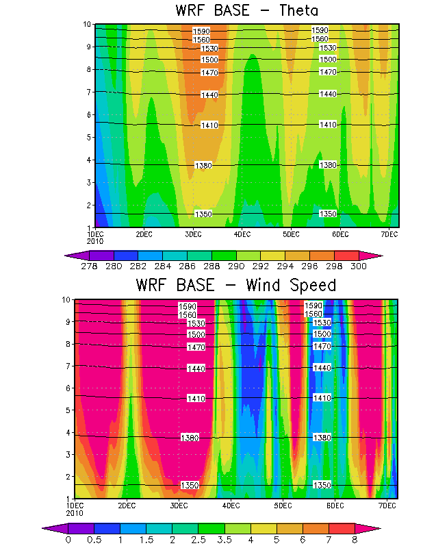
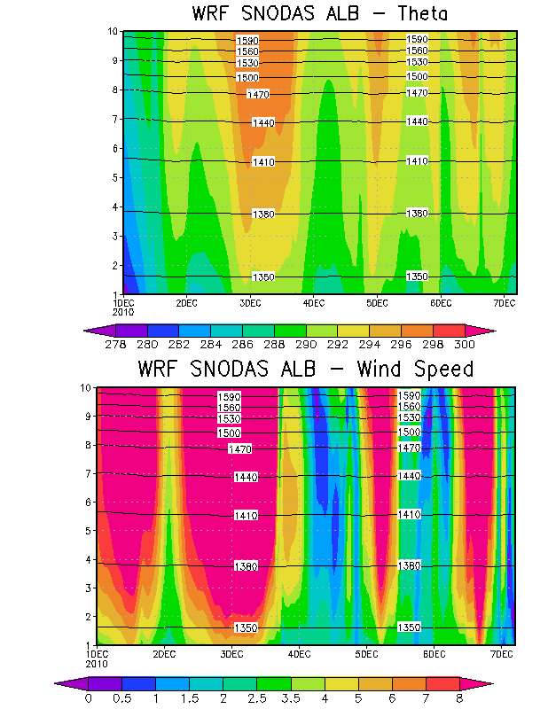
We have found the PCAPS data provides a very useful dataset for evaluation of CAP meteorology. We have compared the potential temperature time height profile from PCAPS for different observational periods with WRF. The example below is the potential temperature and wind speed time height comparison for December 1st - 6th 2010. This is a known cold air pool event with a disturbance (weak trough) that impacts the CAP on December 3rd.
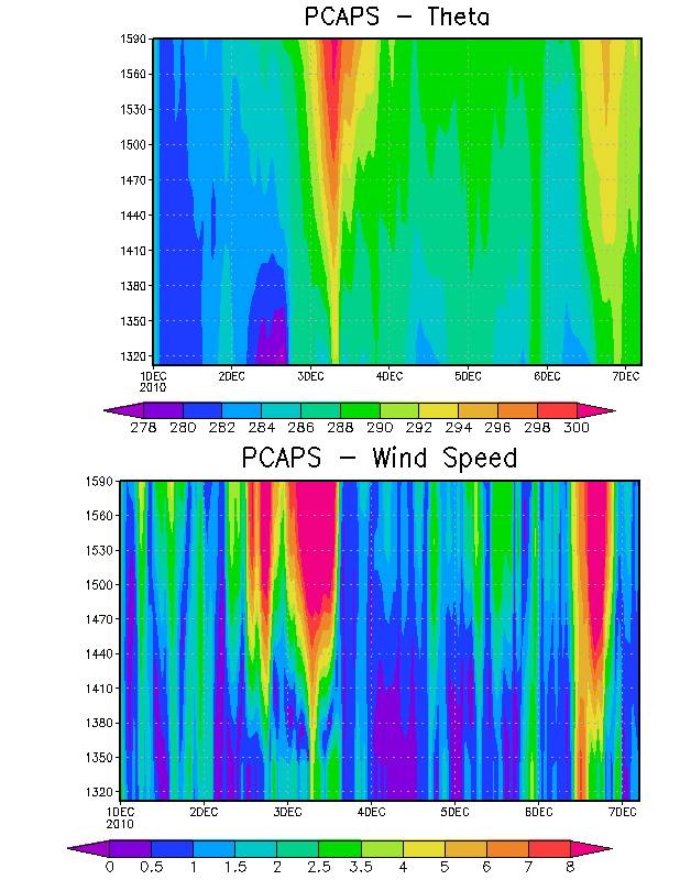
Comparing the BASE and SNODAS configurations for the same period provides a general sense of the problem with WRF Winter Modeling. Overall, both the BASE and SNODAS configurations are too warm with wind speed overestimated in the boundary layer. Other events during PCAPS shows very similar results. The initial thought is that snow cover (depth) may not be as important as anticipated for simulating CAP meteorology. The PBL heights in this case would be overestimated with WRF.